
We deploy a number of research methods across our programmes. Find out more about these techniques below:
Photo Identification (photo-ID)
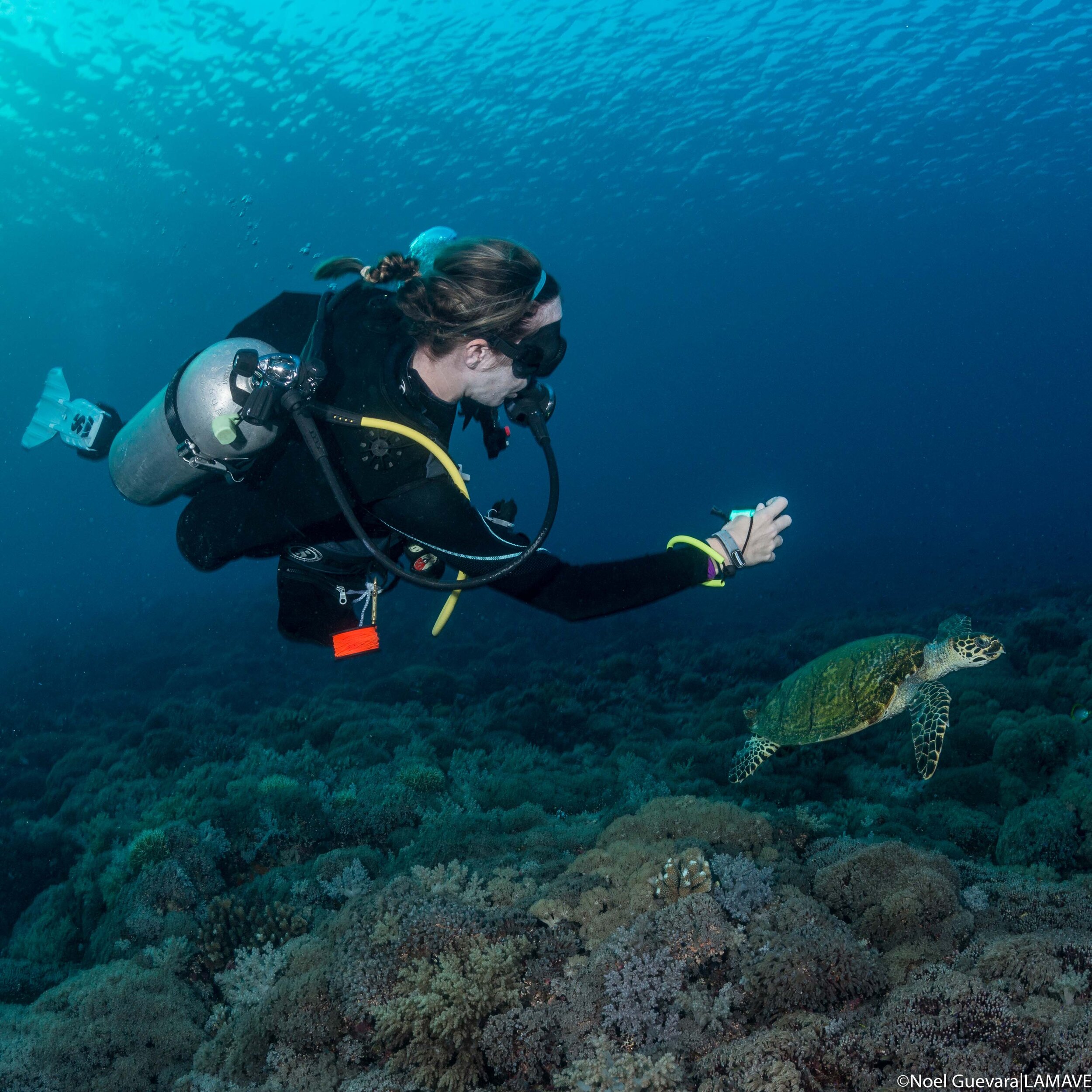
Photographic identification (photo-ID) is one of the main research techniques we use to understand the species’ ecology of marine megafauna. It is a scientifically proven method for "tagging" animals, using photographs of their unique natural markings. This is a cost-effective, non-invasive technique that can be used to determine population structures, residency patterns and track local and international movements.
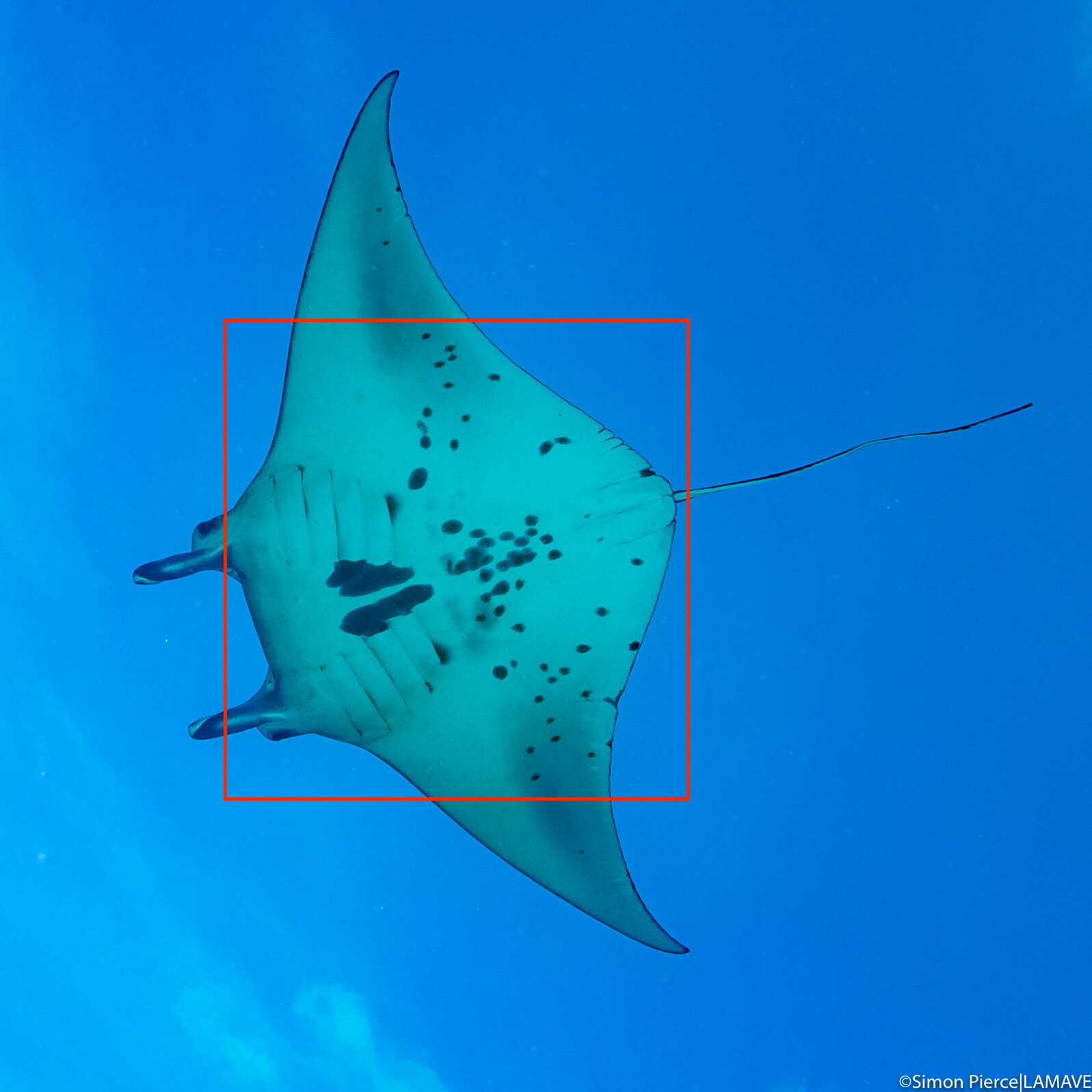
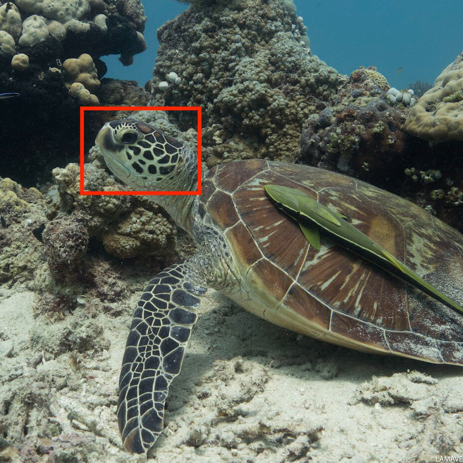
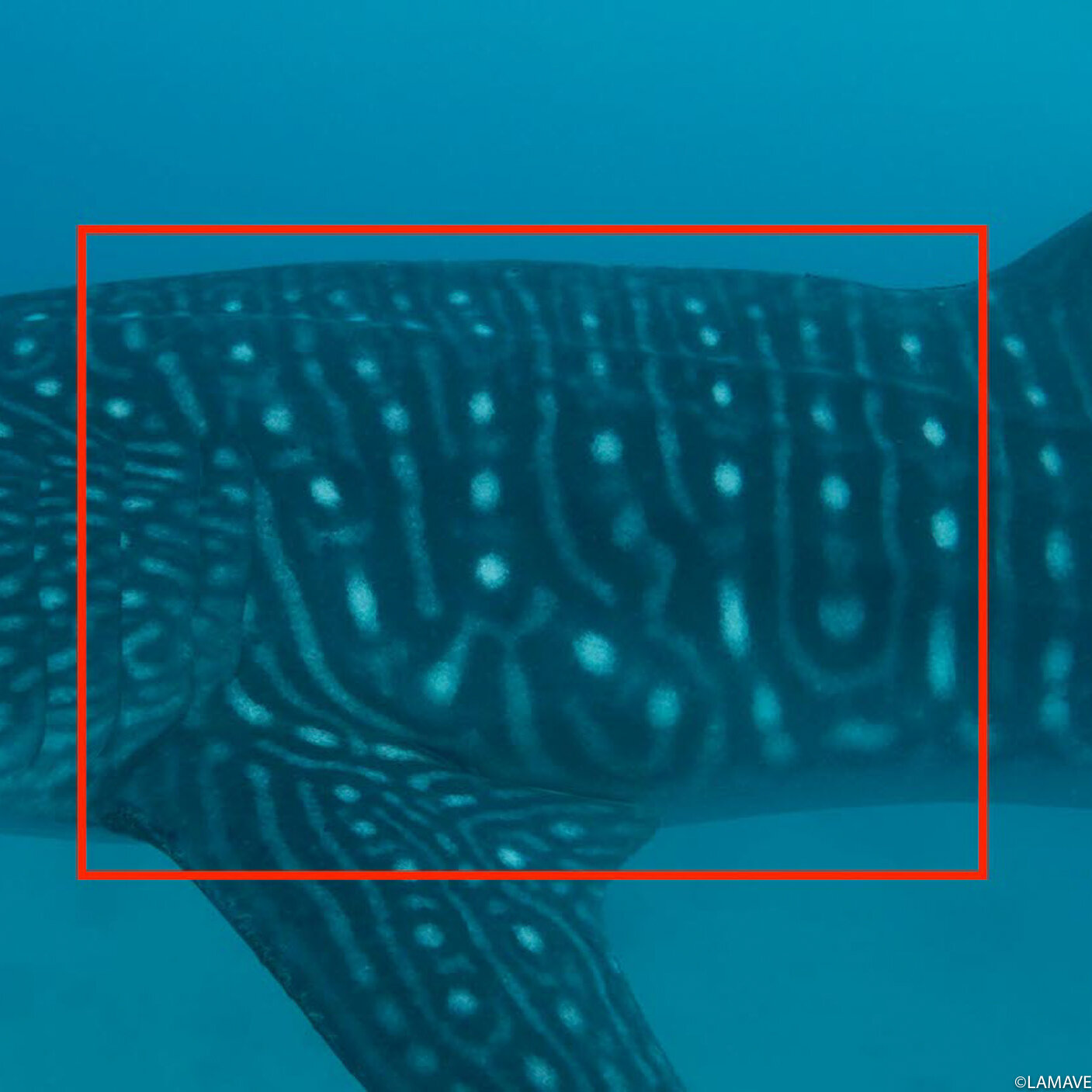
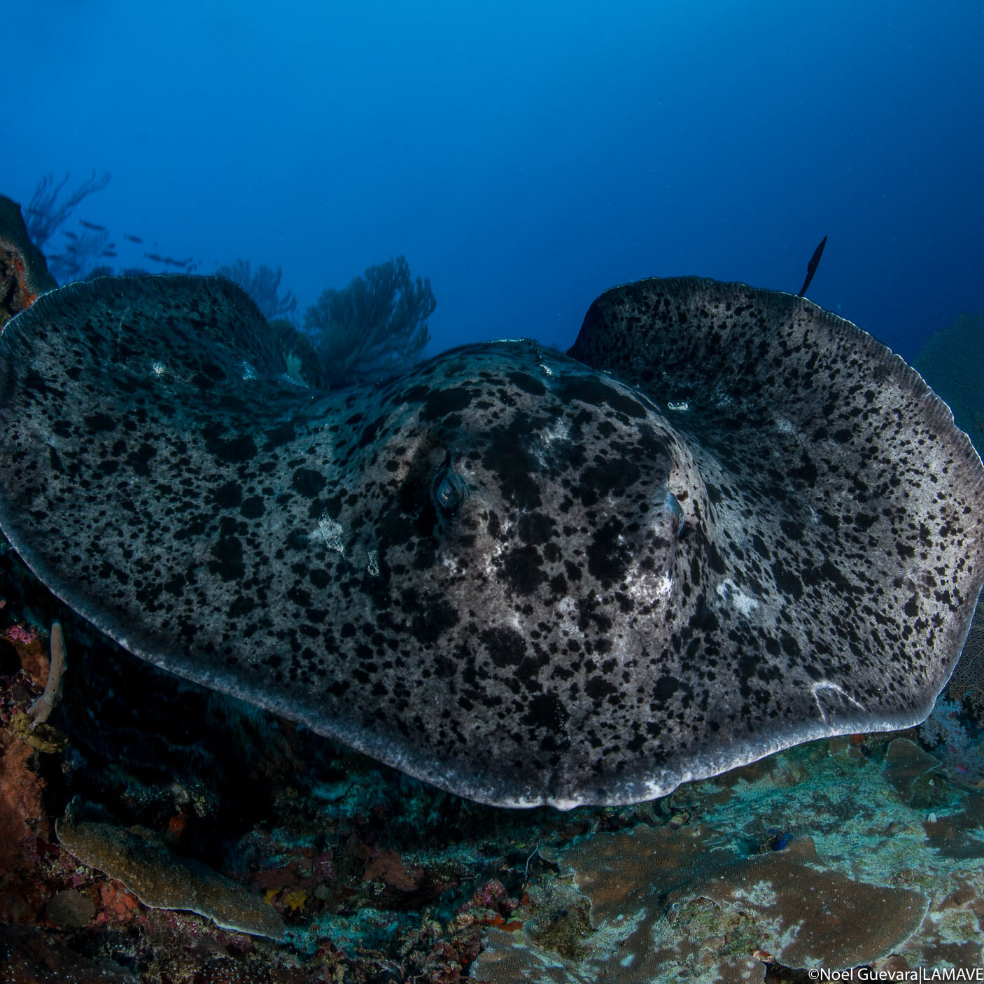
Researchers have discovered that the spot-pattern on a whale shark’s skin is unique to each individual. This is similar with sea turtles (through their facial scutes), manta rays (through their ventral spots) and dolphins (through nicks and notches on their dorsal fin).
To date, we have employed this technique across our research project sites in Bohol, Cebu, Masbate, Negros Oriental, Palawan, Sorsogon and Southern Leyte.
With the use of Photo-ID, a software based on star-mapping algorithm was developed to identify and match spot patterns of whale sharks found in different areas. This has helped the Philippines become recognised as hosting the second largest population of whale sharks in the world, through WildBook for Whale Sharks, an online global library.
Photo-ID has also allowed our team to build a national catalogue for mantas, sea turtles and whale sharks. We also use this technique to study dolphins. This effort can be complemented by the general public, who can also engage in collecting photo-ID data through citizen science. Find out how you can contribute.


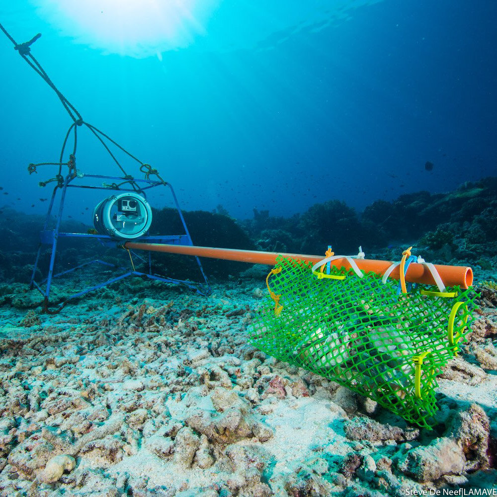
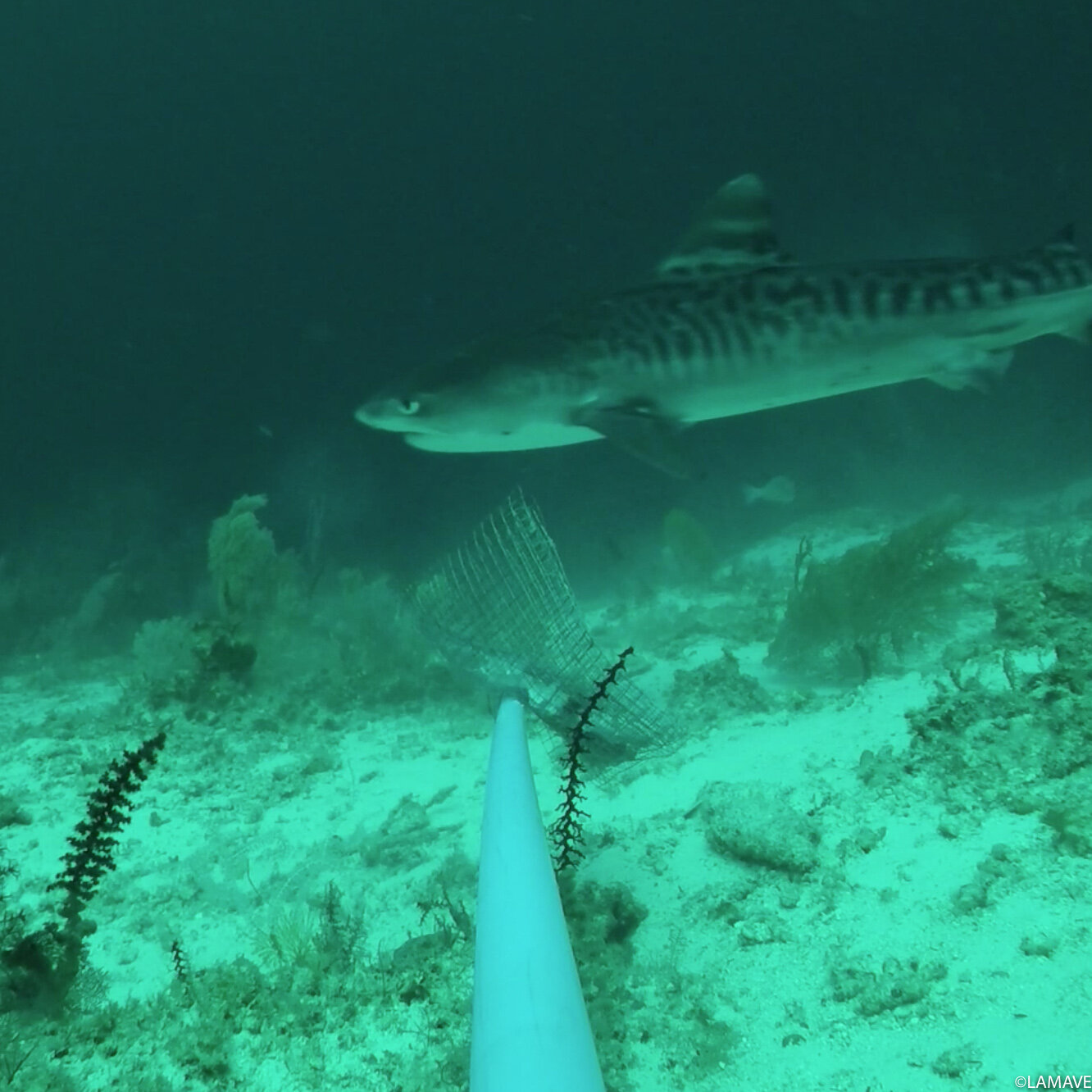
Baited Remote Underwater Video (BRUV) Systems
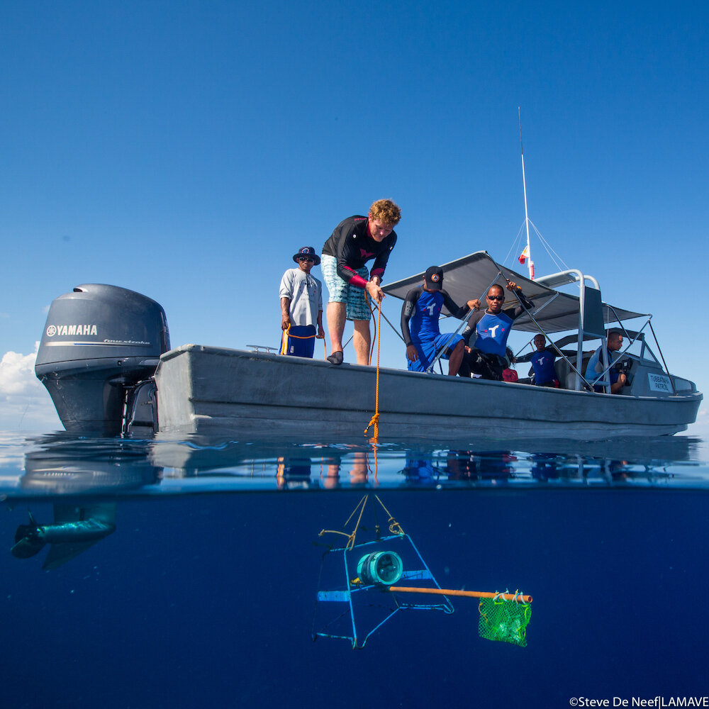
BRUVs are unique camera systems, which are baited to draw the attention of sharks and rays. They are left to record at various depths and then on retrieval, the video footage is played back to identify the presence and abundance of different species of sharks and rays. It is an innovative research technique that can assess the effectiveness of Marine Protected Areas (MPAs) especially for elsamobranchs.
Our team initially used this method in Tubbataha Reefs Natural Park as part of a nationwide shark and ray assessment as part of Global Fin Print, a worldwide study on shark and rays. Amzingly, within Tubbataha Reefs our findings helped show that the area has one of the highest density of grey and whitetip reef sharks worldwide. Aside from this, key study sites include Apo Reef National Park and the municipality of Cagayancillio, which was recently declared the largest MPA in the Philippines. Our team have also supported Apo Reef Natural Park and GIZ with the use of Stereo BRUVS to assess shark biomass in this protected area.
Remote Underwater Video (RUV) Systems
Remote Underwater Video Systems (RUVs) are special underwater cameras that allow researchers to record areas for a prolonged length of time without human presence. These system allows cameras to be remotely placed underwater where they can capture individuals of certain species through videos. Combined with the use of photo-ID, this method can be used to monitor individual animals in key areas.
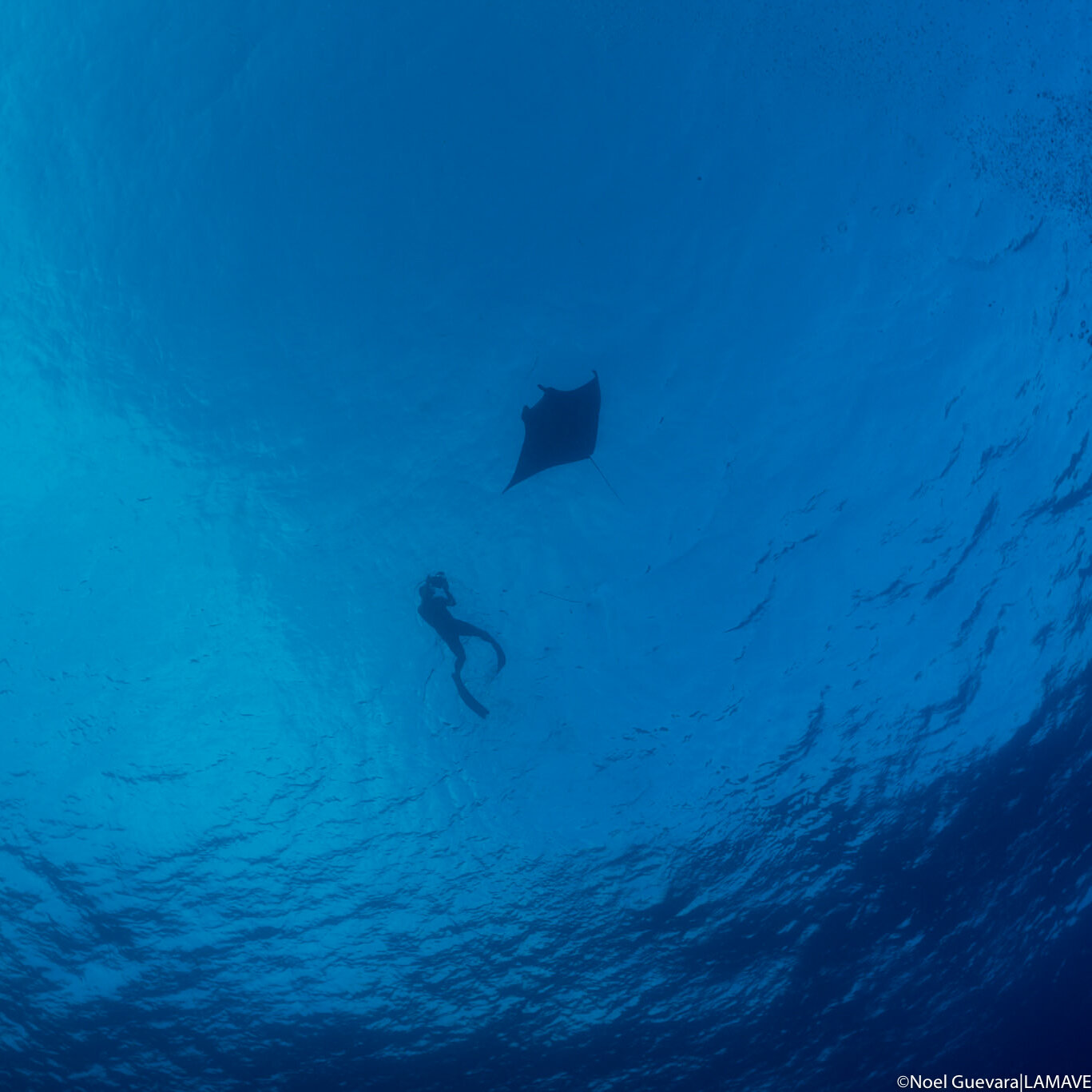
Our team are currently using RUVs to study manta rays in two sites in the Philippines – North Palawan and Manta Bowl, Ticao. We are using the cameras to study individual manta rays visiting cleaning stations. The spot pattern on the belly of the manta is unique to each individual. The RUV records any mantas visiting the site and we later analyse the footage to see if the animals are new or returning individuals.
Check out a collaborative project we are part of to make this technology more efficient and affordable: Open Ocean Camera.


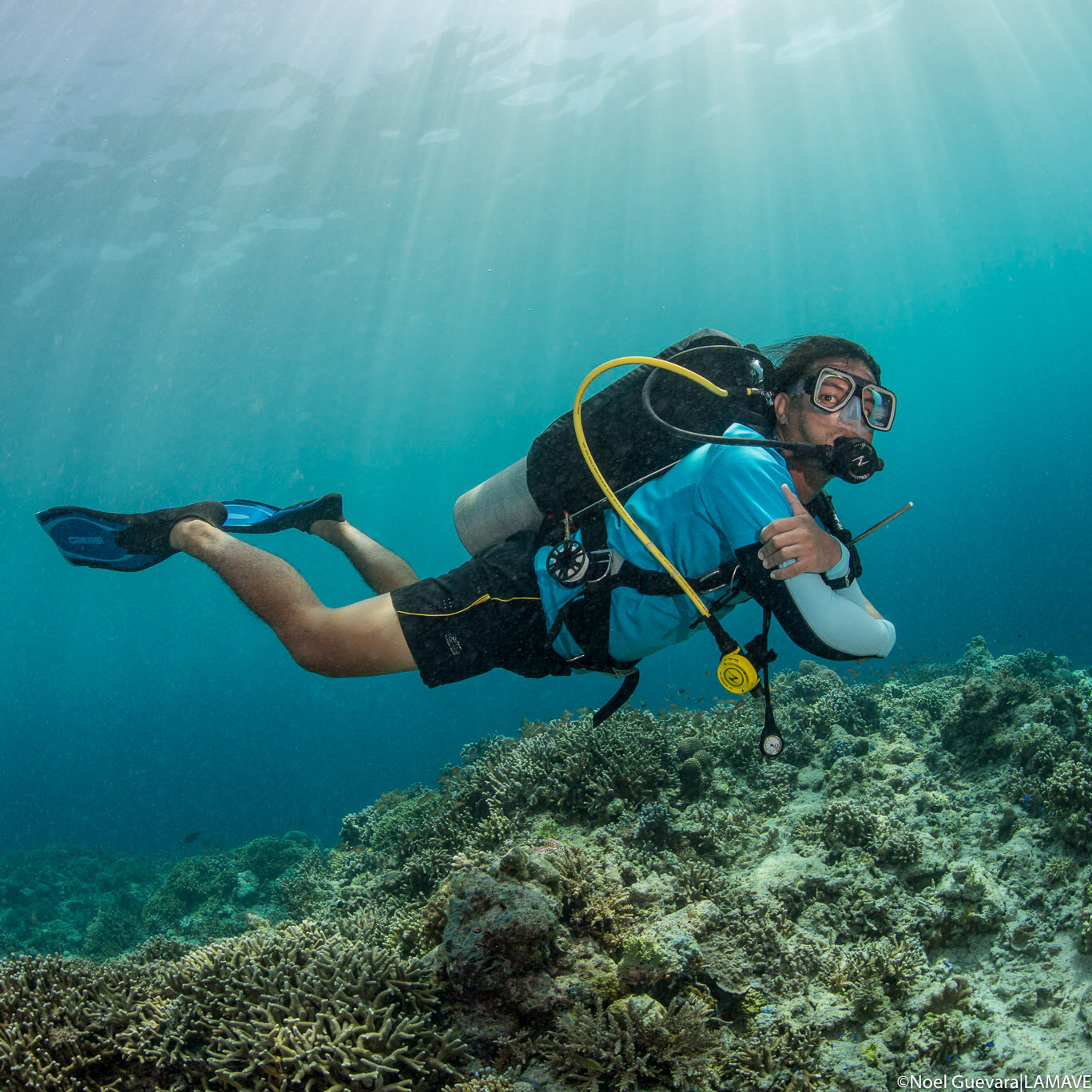
Underwater Visual Surveys
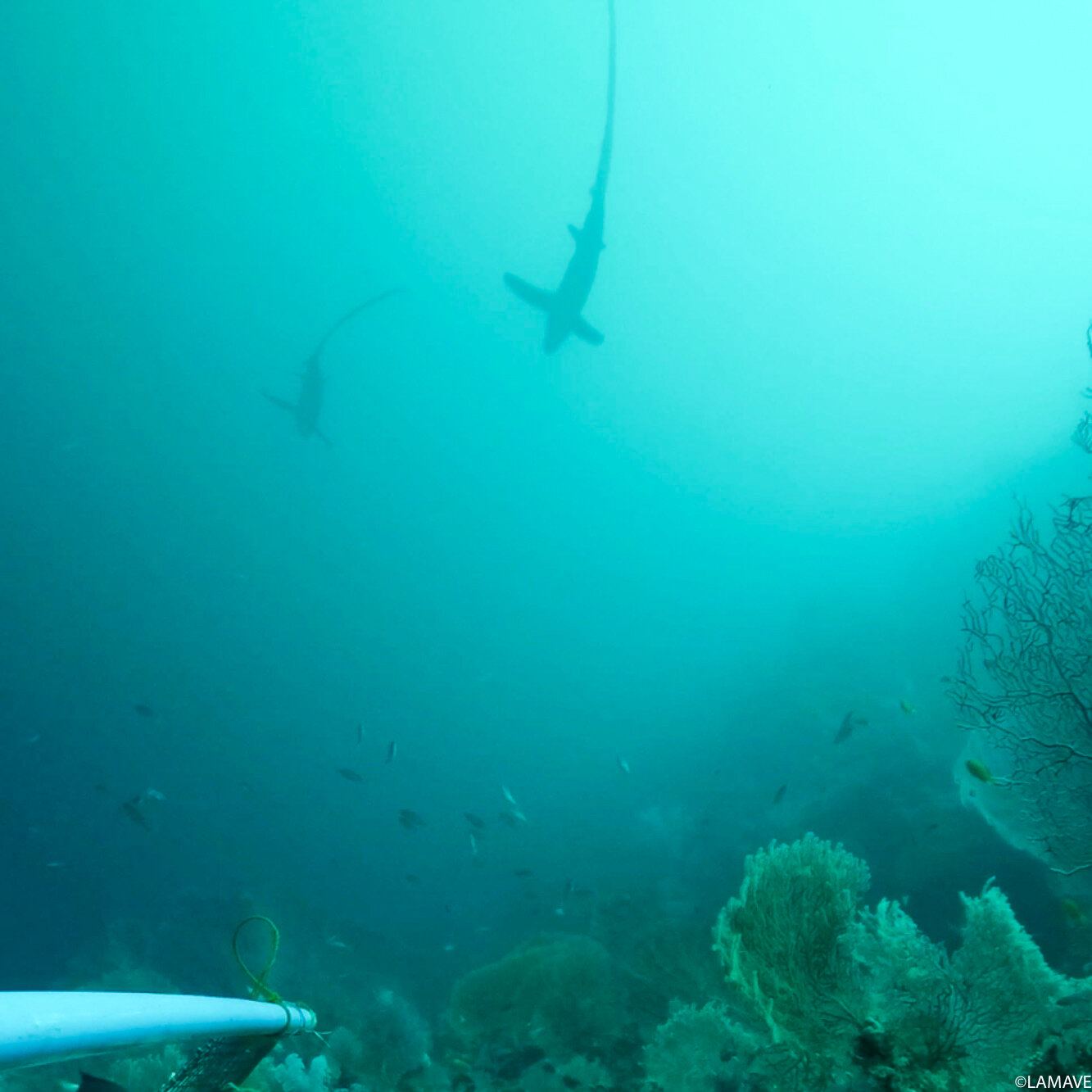
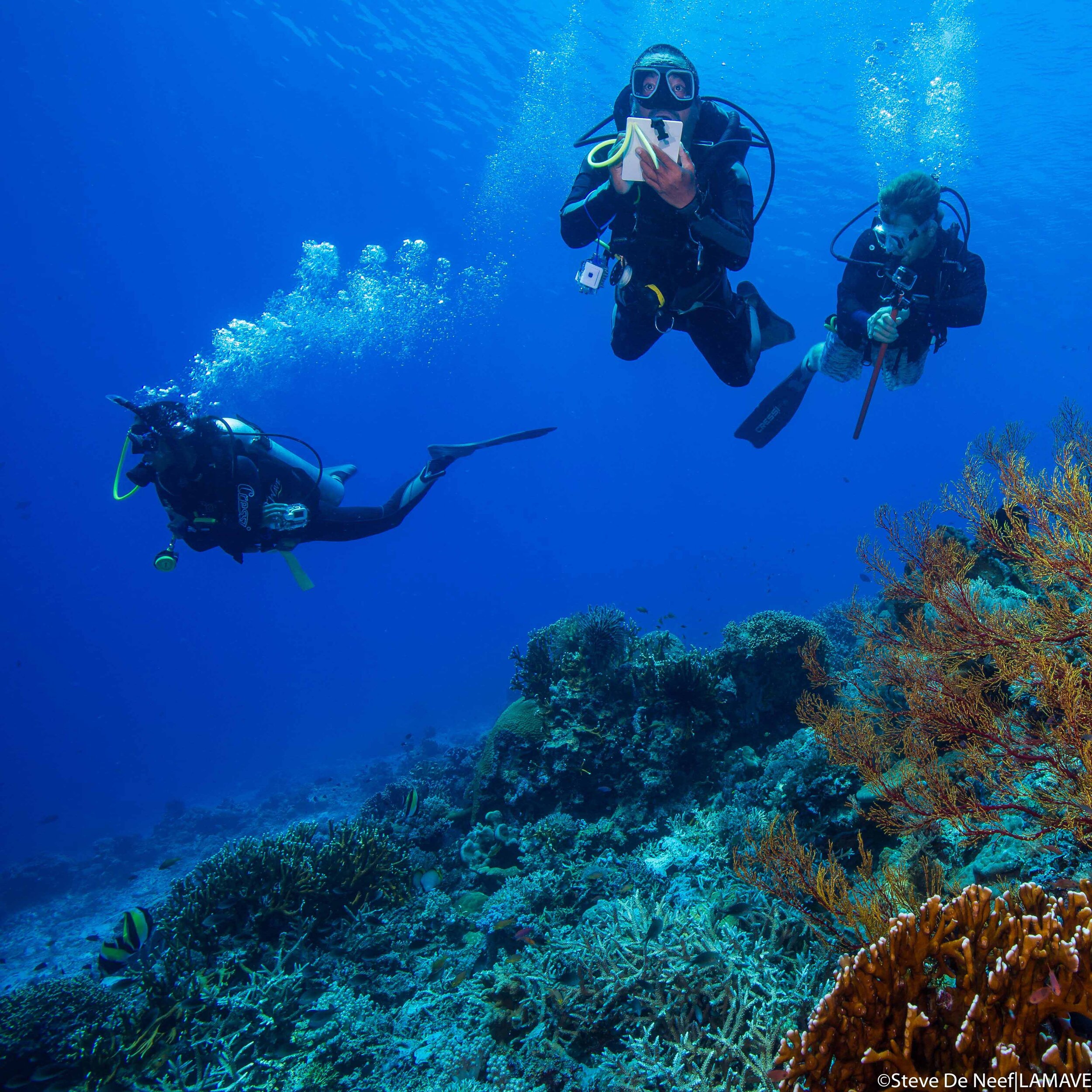
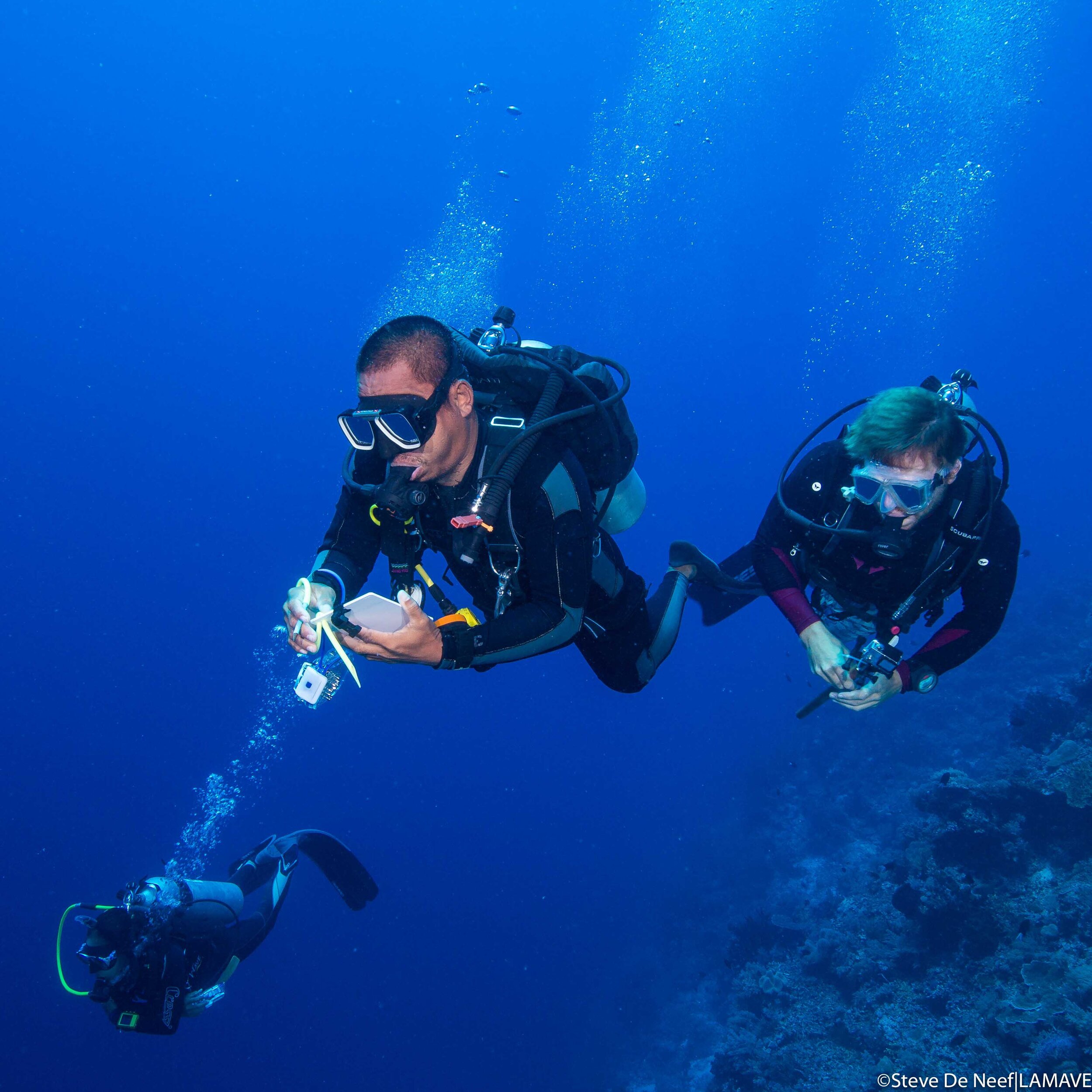
Diver-based Underwater Visual Surveys (UVS) are surveys conducted by scuba divers along a set transect with a set of parameters for studying certain species. These transect-based surveys, are key tools in the study of fish ecology and have been applied directly to estimating density of reef sharks. This technique has been employed by our research team in collaboration with the Tubbataha Management Office to assess abundance and trends in population presence and distributions of sharks and rays in Tubbataha Reefs Natural Park.
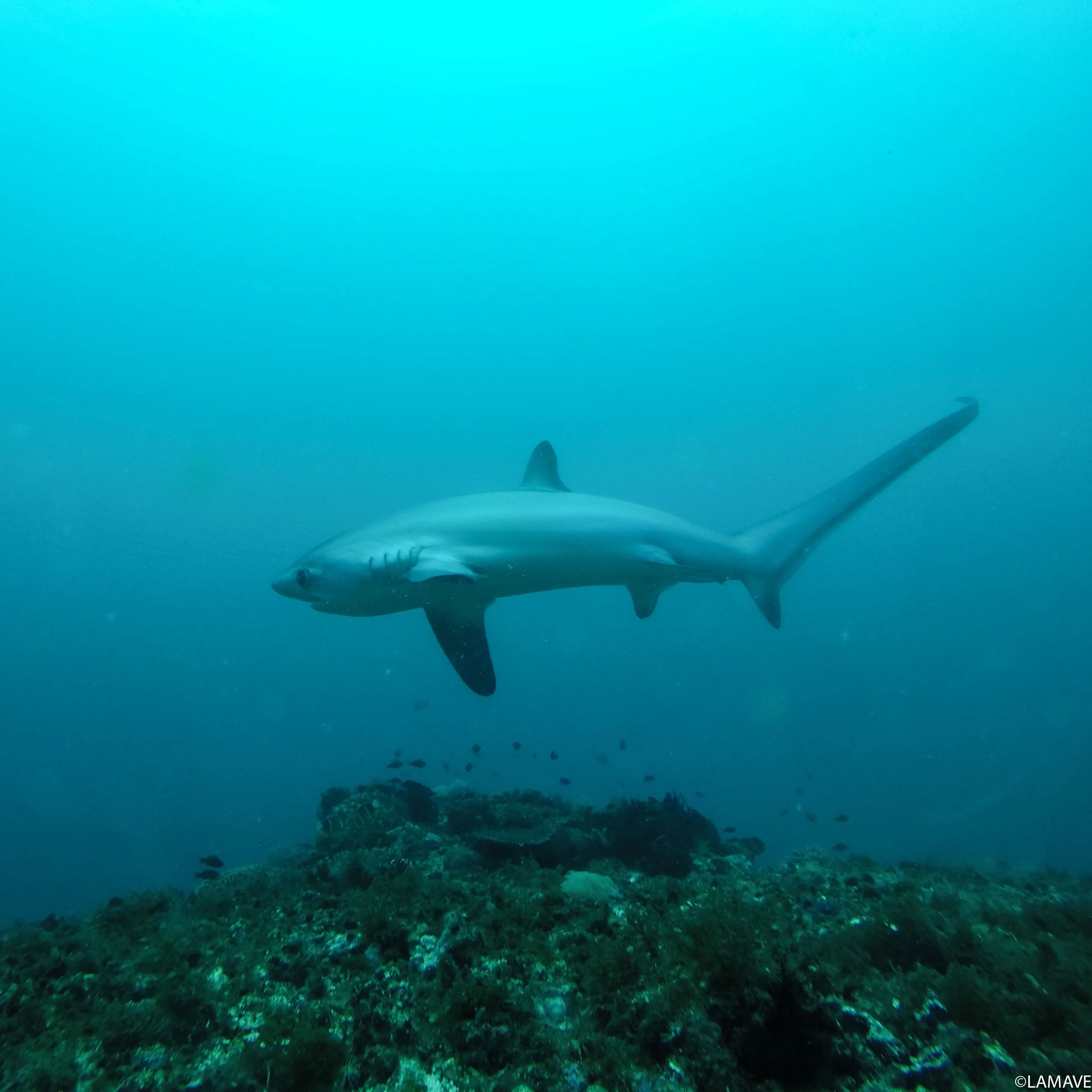
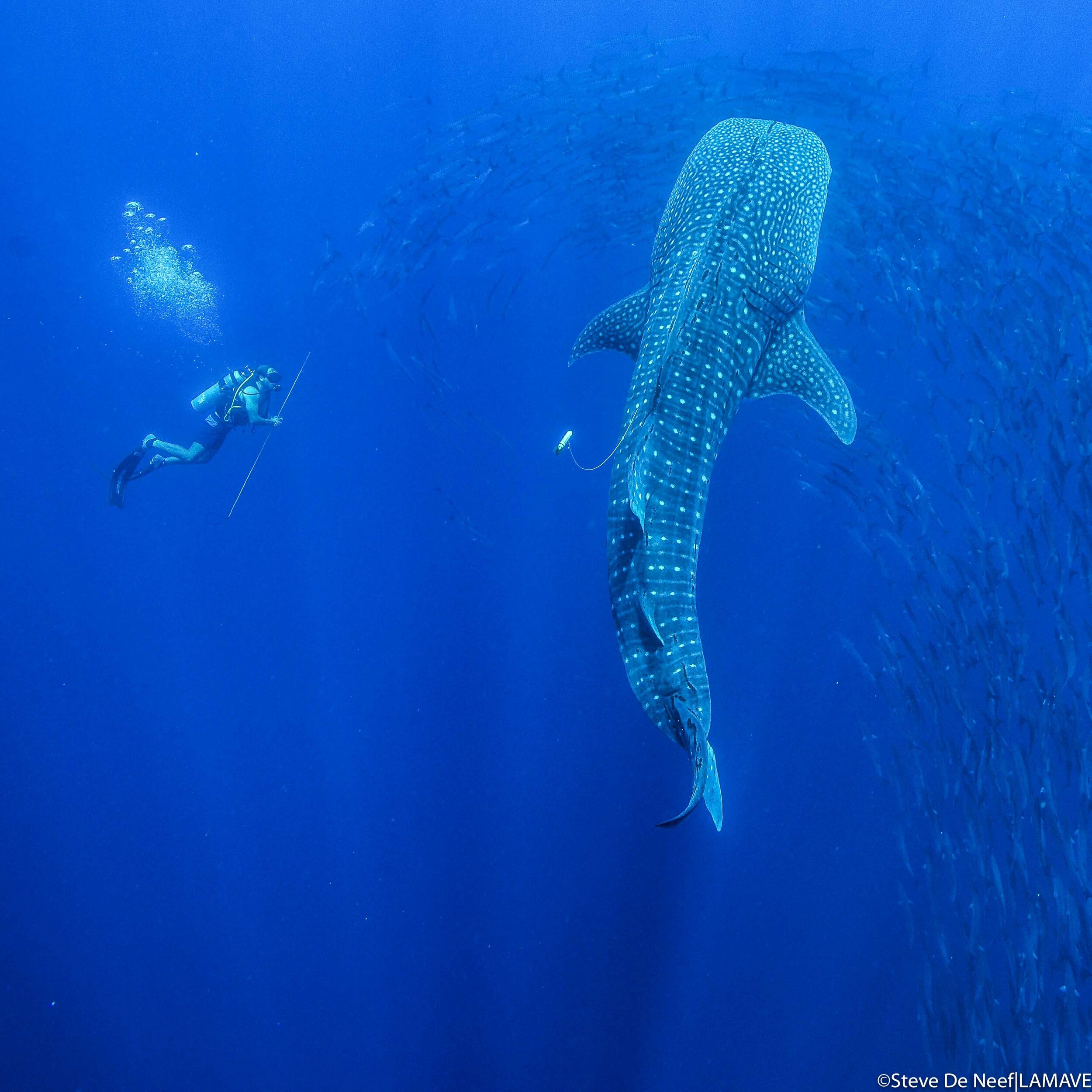
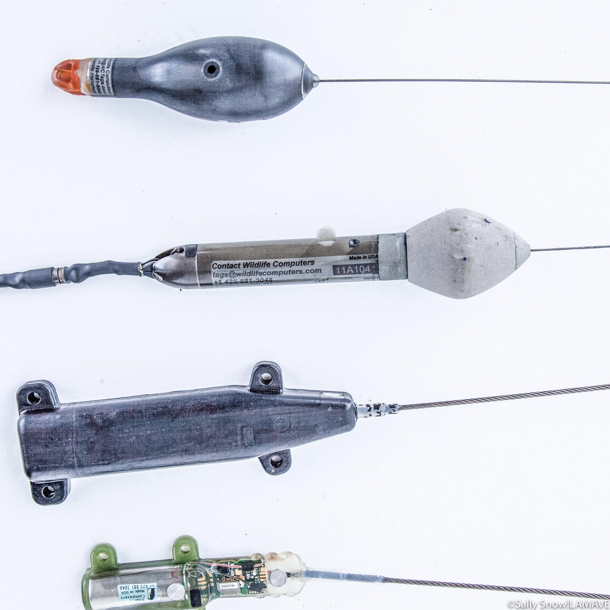
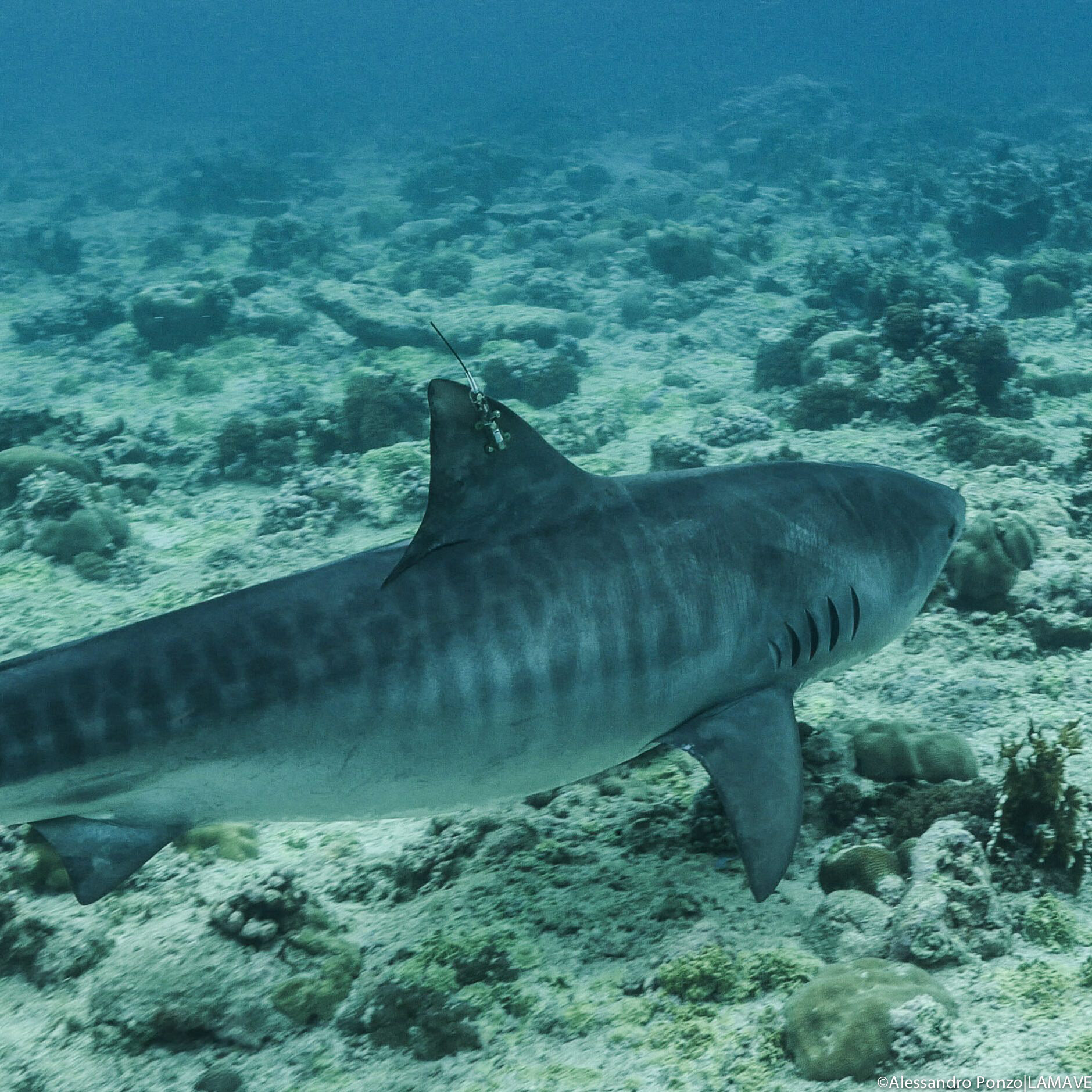
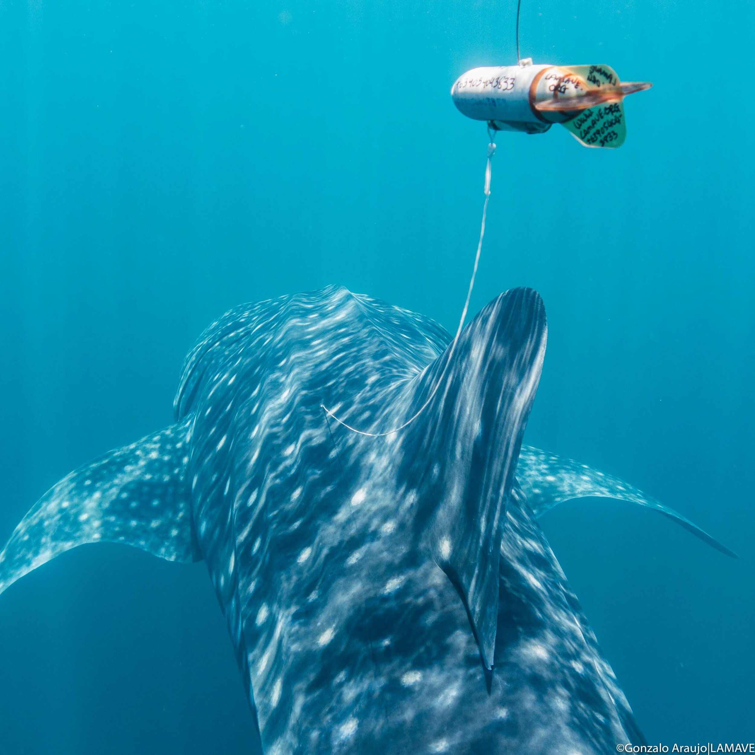
Satellite Telemetry (Tags)
Satellite tags are used mainly to track individuals’ movement and location.
There are many different types of satellite tags yet they all have one thing in common - they relay signals to passing satellites. Some tags are archival, or collect data for a set period of time and then pop-off and transmit all data while on the surface (PAT-tags) while others send signals each time the antenna breaks the surface offering a more current idea of an animal’s location (SPOT tags). Our team use satellite tags to study the movements of whale sharks, tiger sharks and turtles.
Between 2015-16 in collaboration with the Tubbataha Management Office and the Marine Megafauna Foundation our team tagged 17 whale in three different locations in the Philippines: Panaon Island (Southern Leyte), northern Mindanao (Misamis Oriental and Surigao del Norte) and Tubbataha Reefs Natural Park (Palawan). Watch the video to find out where the sharks went.


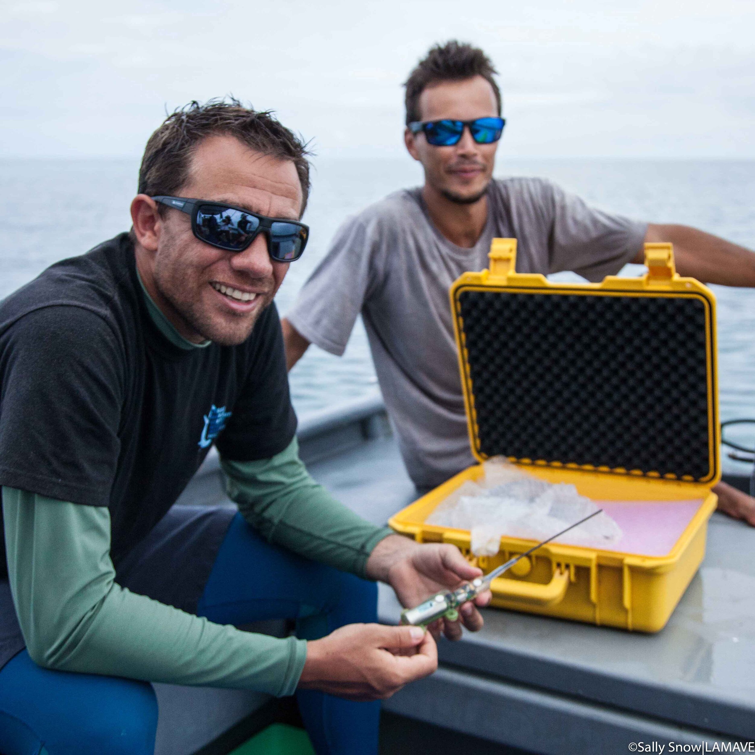
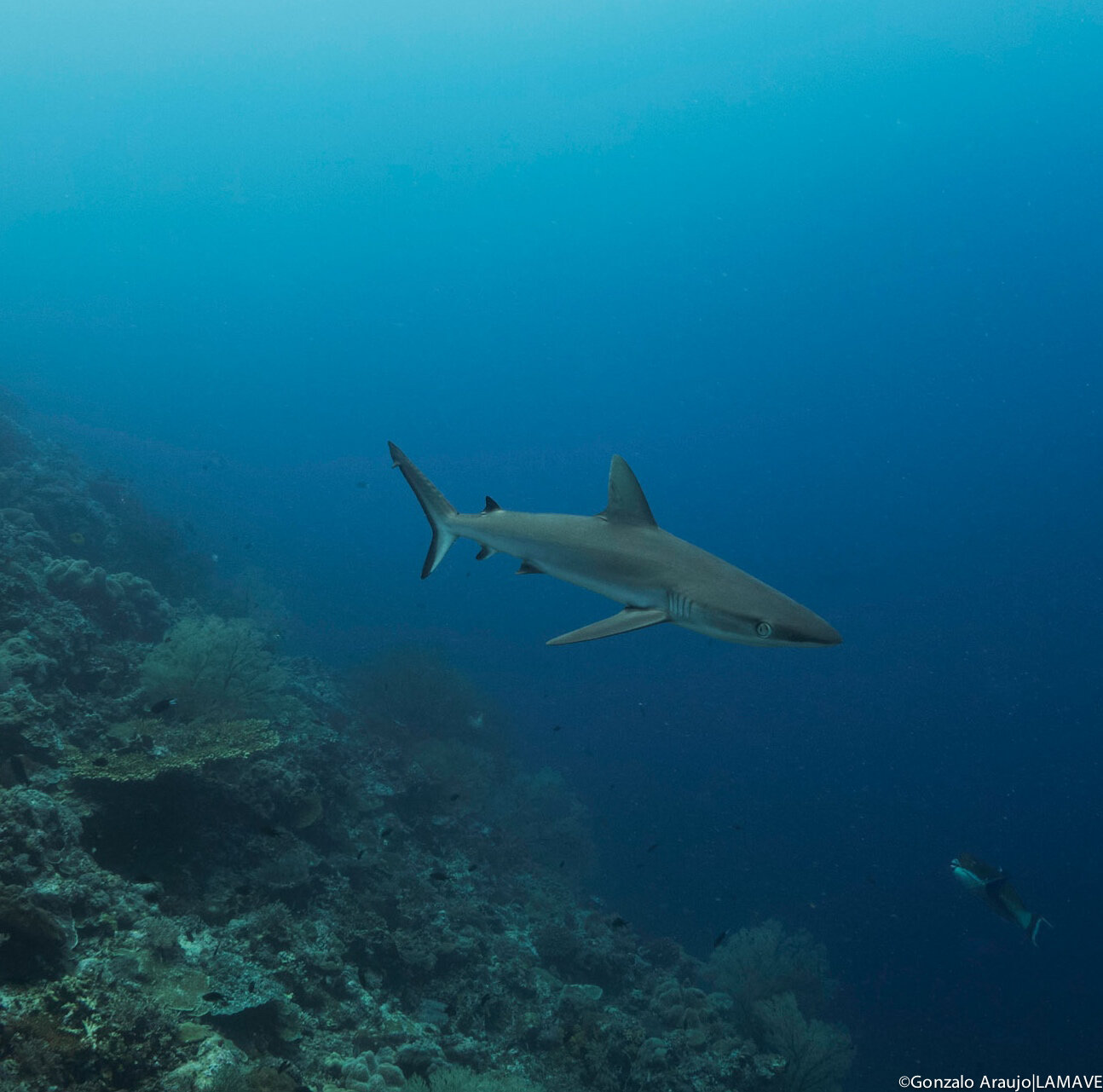
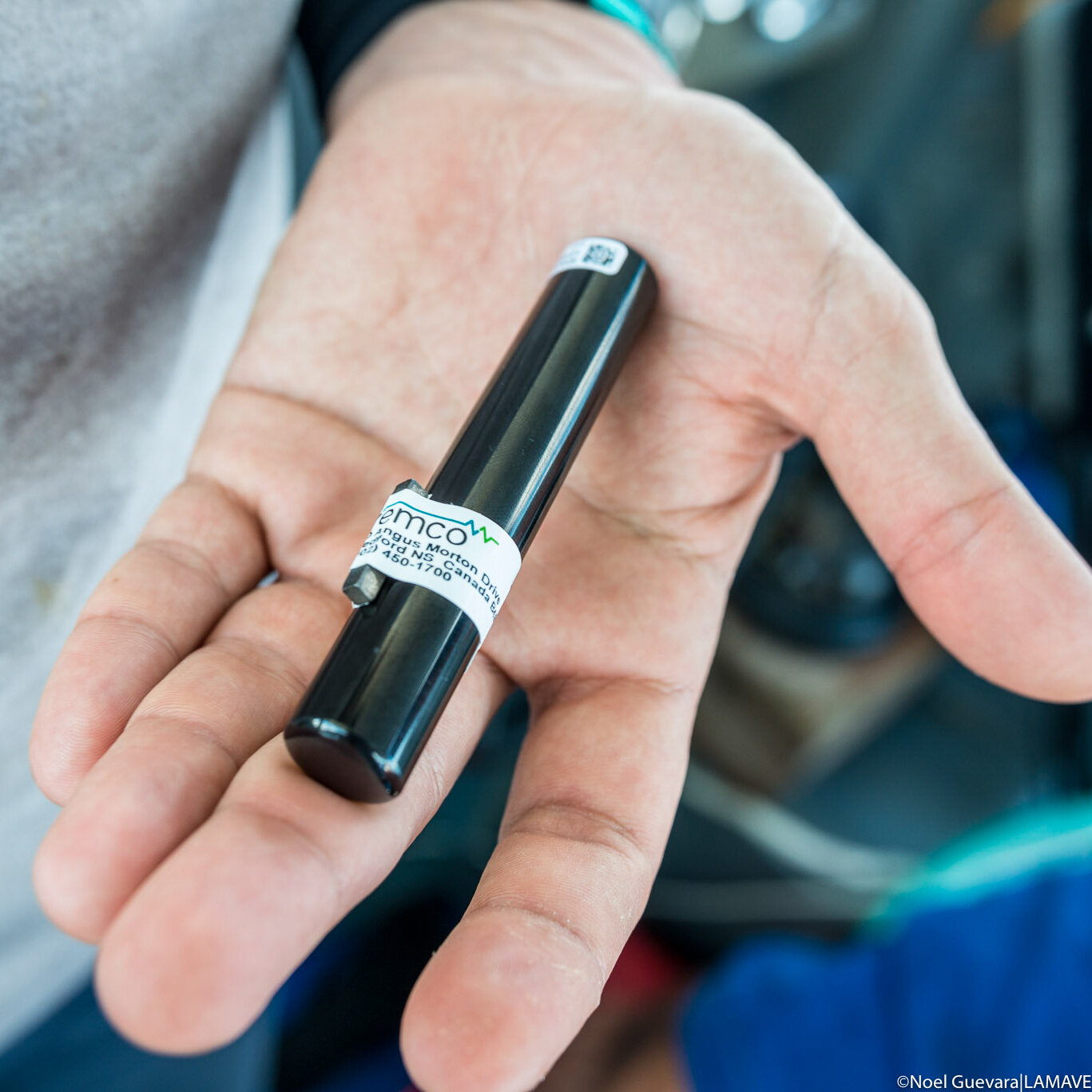
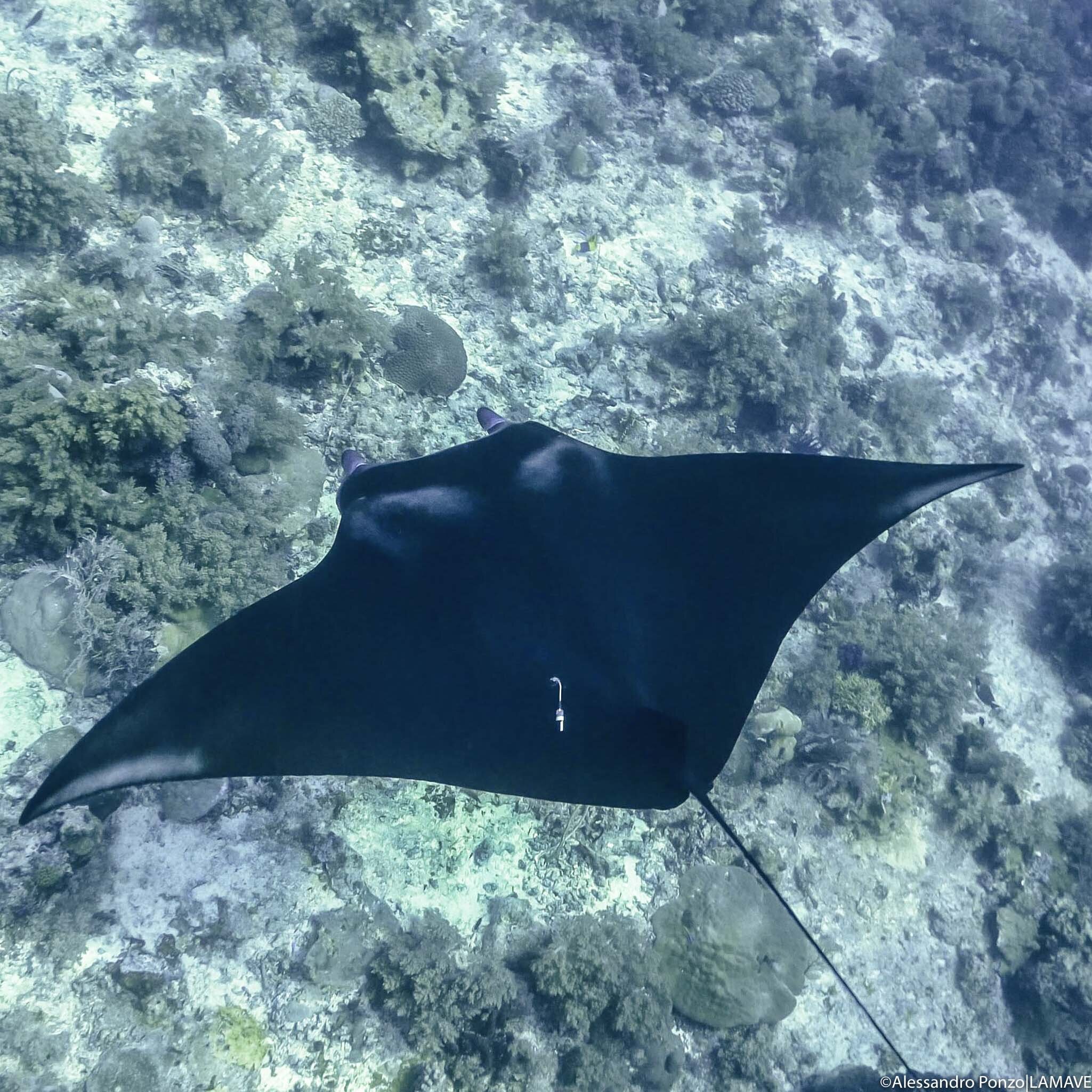
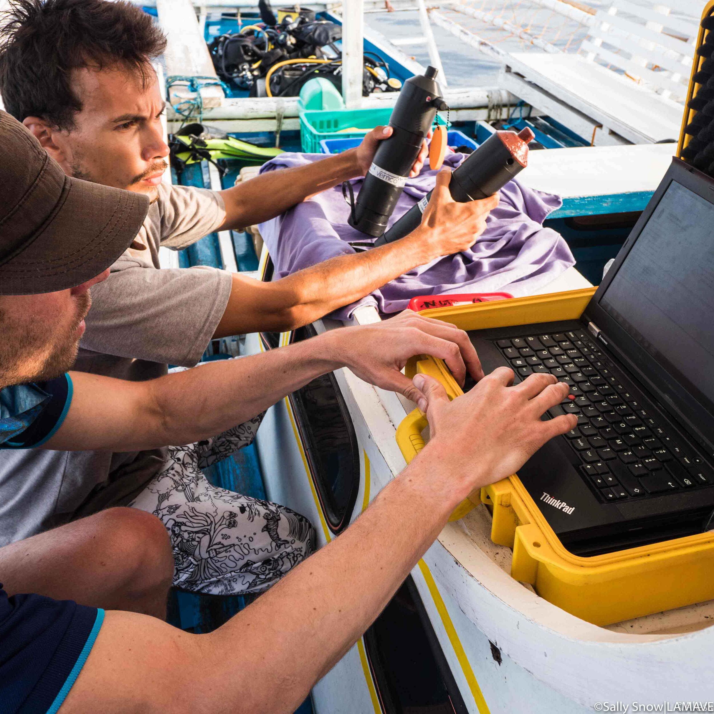
Acoustic Telemetry (Tags)
Acoustic tags can be used to study the activity patterns of sharks and rays, providing invaluable insights into the short term movements, site fidelity and reef connectivity of these animals. LAMAVE have been using acoustic tags to study tiger sharks, reef sharks and manta rays since 2016.
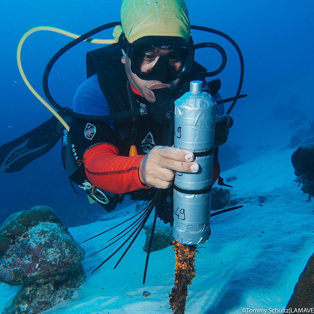
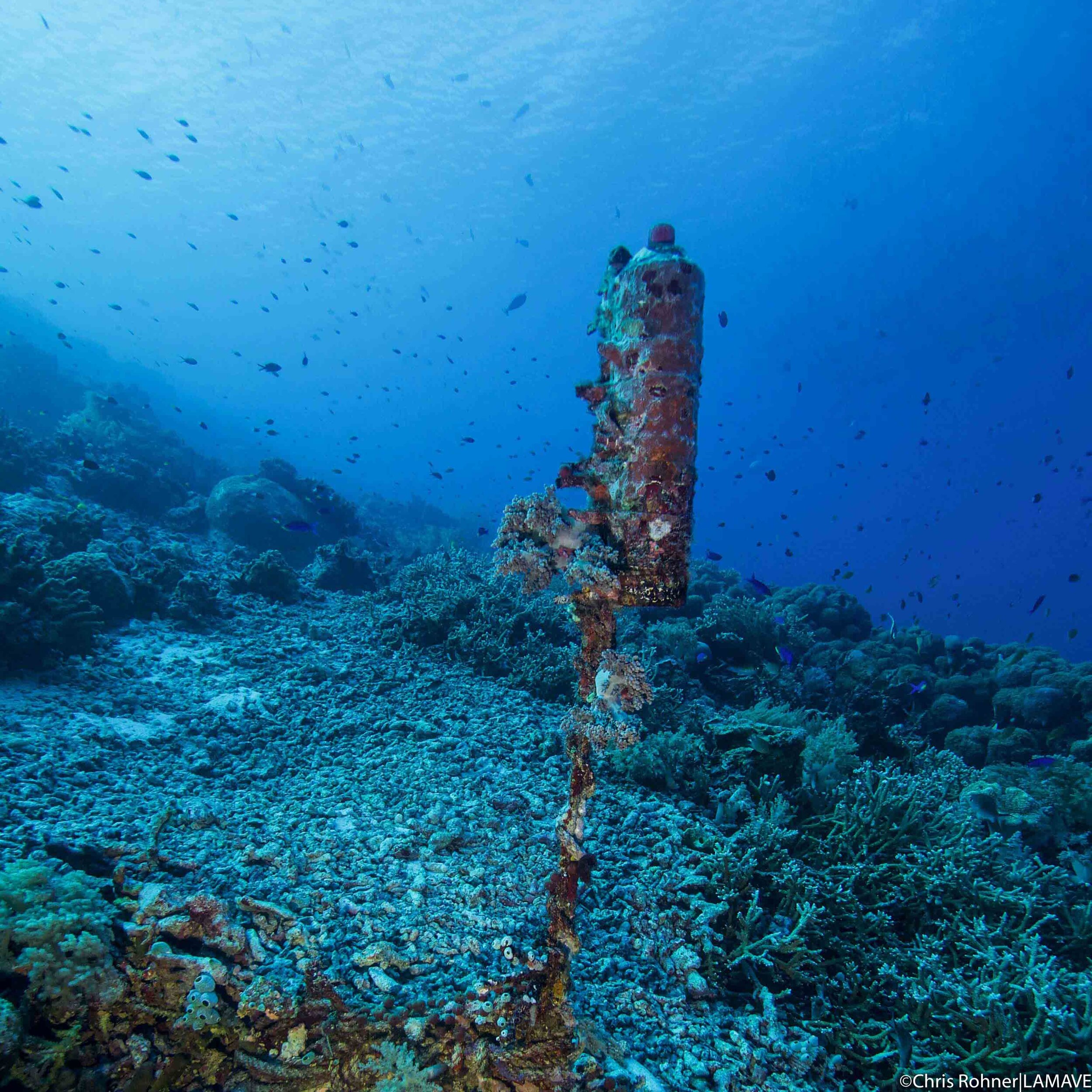
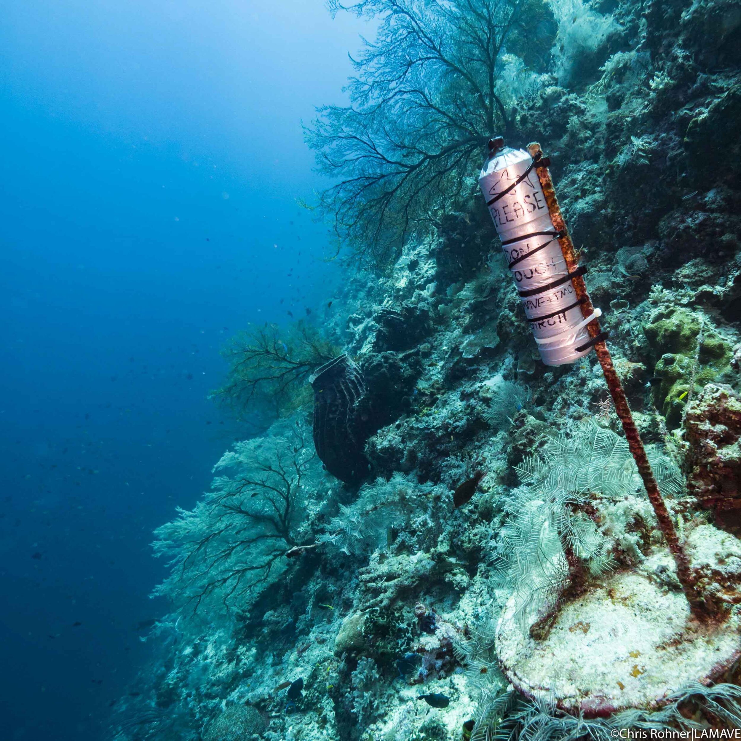
When attached to a shark or ray, these small tags send signals to specially placed receivers that have been positioned underwater, usually around 20-30 meters deep, by our team. Acoustic tags provide an insight into habitat use, across space and time. The tags which have up to 10 years’ battery life work by communicating with acoustic receivers positioned around the park. When a tagged shark or ray swims within 500 meters of a receiver a signal is transmitted and recorded. Over time these signals create a map of an individual shark’s movements and presence within a set area.
To date, most of our efforts using this technology have been in Tubbataha Reefs Natural Park. Currently with the Tubbataha Management Office our team has positioned seven receivers in the Park that are picking up signals from tagged animals. The project is a long-term study that is ongoing, with new tags and receivers deployed every year and with a focus on tiger, grey reef sharks and reef mantas. The team are currently expanding this network across the Philippines to build a larger map of shark and ray movements within the country, locations include and Cagayancillo, Manta Bowl and islands in the Visayas.
Collaborative efforts highlight the long-distance movements of whale sharks in the Sulu-Sulawesi Marine Ecoregion
The whale shark is a highly mobile species, broadly distributed, that can cross boundaries without anyone realising. A recent study in the Philippines highlighted the movement of whale sharks between one site in Palawan, and Malaysia and Indonesia. These results also highlighted the utility of the general public in collecting data for research programmes.